File:Southern Bend Map.png
From 4Dimensions
No higher resolution available.
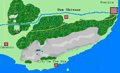
Southern_Bend_Map.png (507 × 307 pixels, file size: 229 KB, MIME type: image/png)
File history
Click on a date/time to view the file as it appeared at that time.
| Date/Time | Thumbnail | Dimensions | User | Comment | |
|---|---|---|---|---|---|
| current | 00:28, 11 February 2021 | | 507 × 307 (229 KB) | Maco (talk | contribs) | |
| 00:01, 11 February 2021 |  | 507 × 307 (229 KB) | Maco (talk | contribs) | ||
| 17:24, 10 February 2021 |  | 507 × 307 (236 KB) | Maco (talk | contribs) | ||
| 17:23, 10 February 2021 | 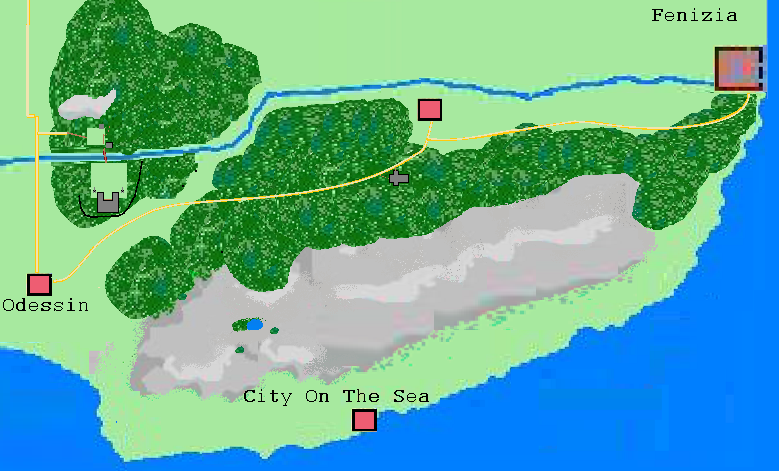 | 779 × 471 (404 KB) | Maco (talk | contribs) | ||
| 17:18, 10 February 2021 |  | 1,562 × 950 (1.18 MB) | Maco (talk | contribs) |
- You cannot overwrite this file.
File usage
The following file is a duplicate of this file (more details):
There are no pages that link to this file.